横切面 Cross-section
教学指引
以下示范如何以 ARGEO Portable 教导横切面单元。
The following demonstration shows the teaching procedures of cross-section by using ARGEO Portable.
选择一个「预设地形(Preset Terrain)
 」或使用「地形塑造
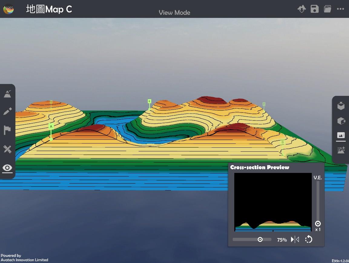
  」功能建设一个地形,以下以在「地图Map C Preset Terrain」绘画A点到B点的横切面图为例子。
Select a landform from “Preset Terrain
” or use “Terrain Modifying ”function to create a landform. The following example is to draw a cross-section from point A to B in “地图Map C Preset Terrain”.

使用「地图介面
 」。
」。Apply “Map View
”.

按「呼唤直尺
 」。
」。Apply “Get Ruler
”.

放置和调校直尺连接AB两点。
Place and adjust the ruler on Point A and B.

将AB两点所穿过的等高线记录在现实的纸条和直尺上。
Record the height of contour lines across the Point A and B on a piece of paper and ruler in real life.

利用已记录高度的纸条绘画横切面图。
Draw the cross-section with the paper which records the height.

使用「观察模式
 」。
」。Apply “View Mode
”.

按「横切面
 」,并使用滑杆标调整横切面位置和垂直夸大率,核对手绘横切面图。
Select “Cross-section
” and use the slider to adjuct and position of cross-section and vertical exaggeration to check the cross-section.
下载教学资源
教学指引 按此下载
工作纸及答案(中文版) 按此下载
工作纸及答案(英文版) 按此下载