面積 Area
教學指引
以下示範如何以 ARGEO Portable 教導面積單元。
The following demonstration shows the teaching procedures of Area by using ARGEO Portable.
計算規則形狀物件的實際面積 Calculate the actual area of regular-shape object.
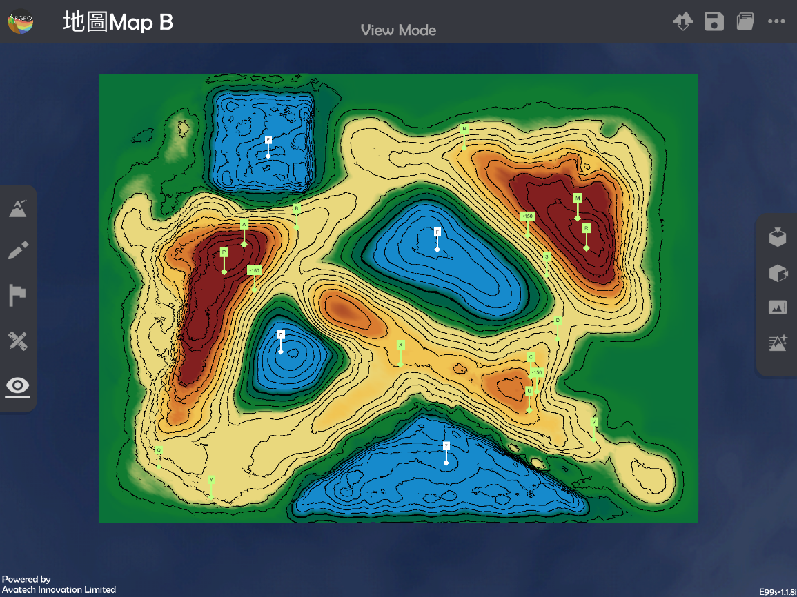
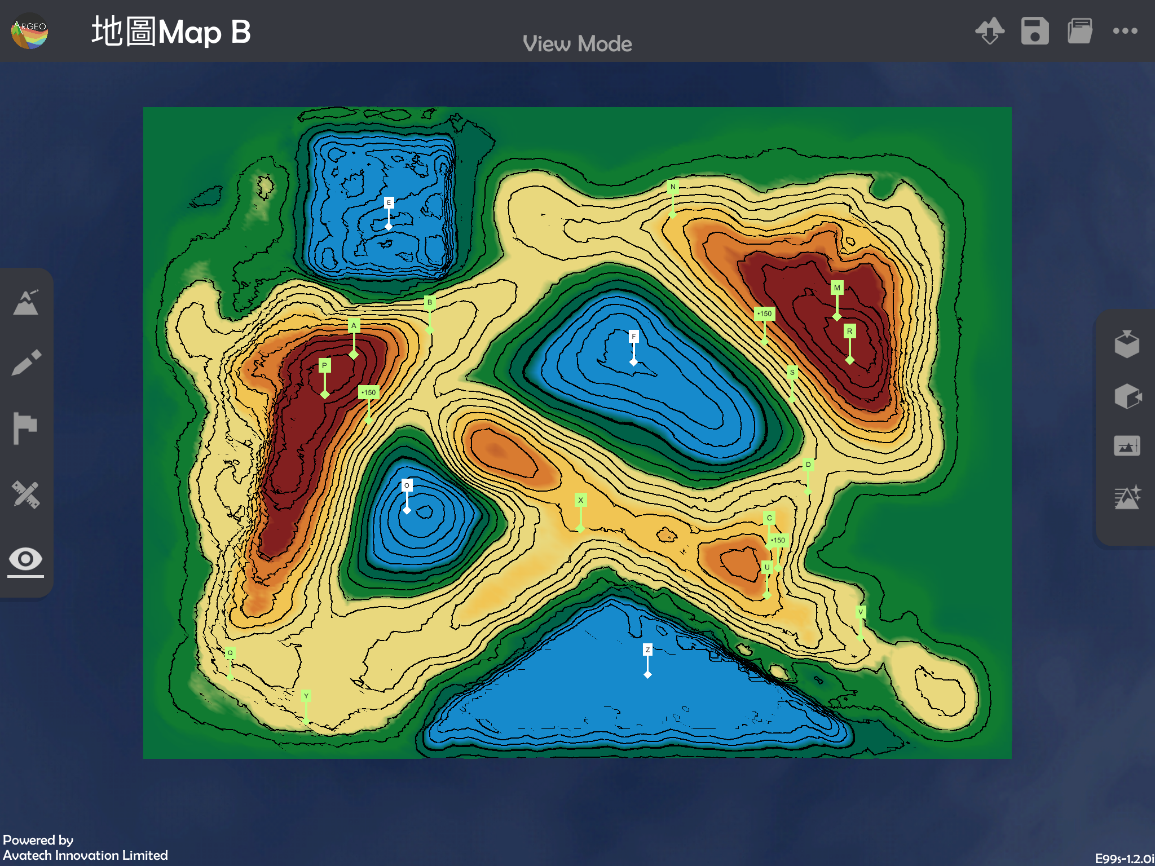
選擇一個「預設地形(Preset Terrain)
 」或使用「地形塑造
  」功能建設一個地形,以下以在「地圖Map B」計算E塘的實際面積為例子。
Select a“Preset Terrain
”or use“Terrain Modifying ”function to form a terrain. The following example is to calculate the actual area of Pond E in “地圖Map B Preset Terrain”
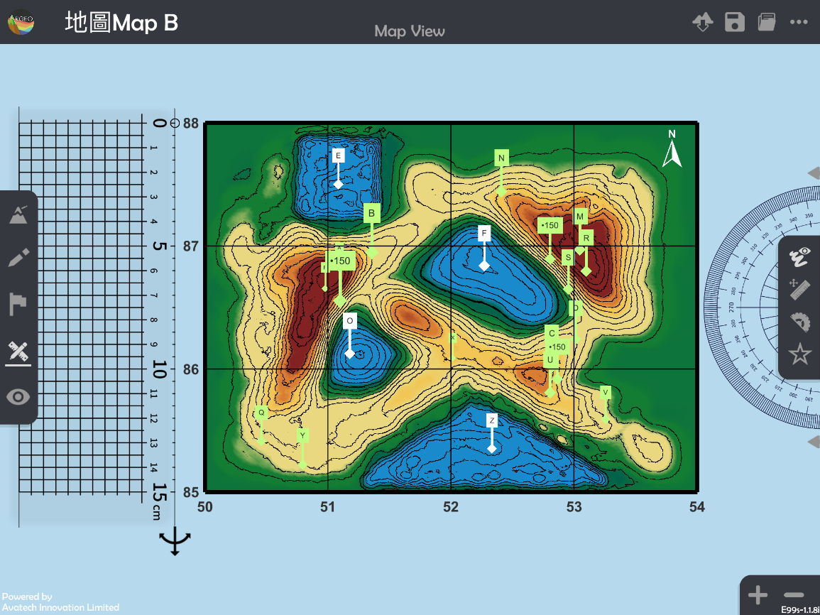
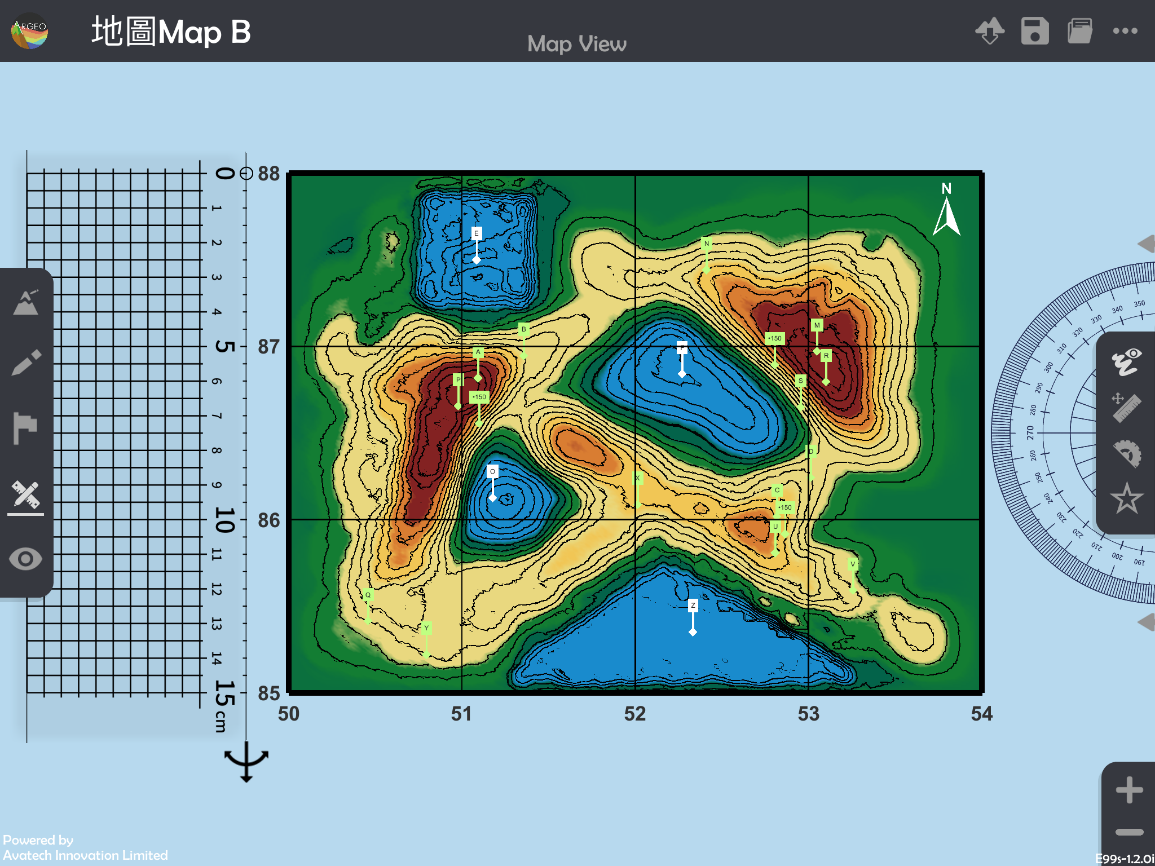
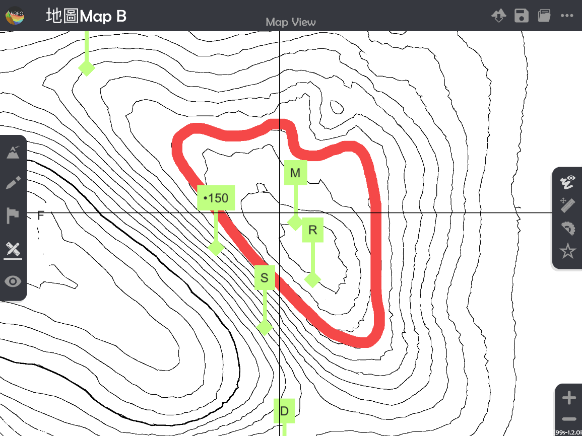
使用「地圖介面
 」。
」。Apply “Map View
「.
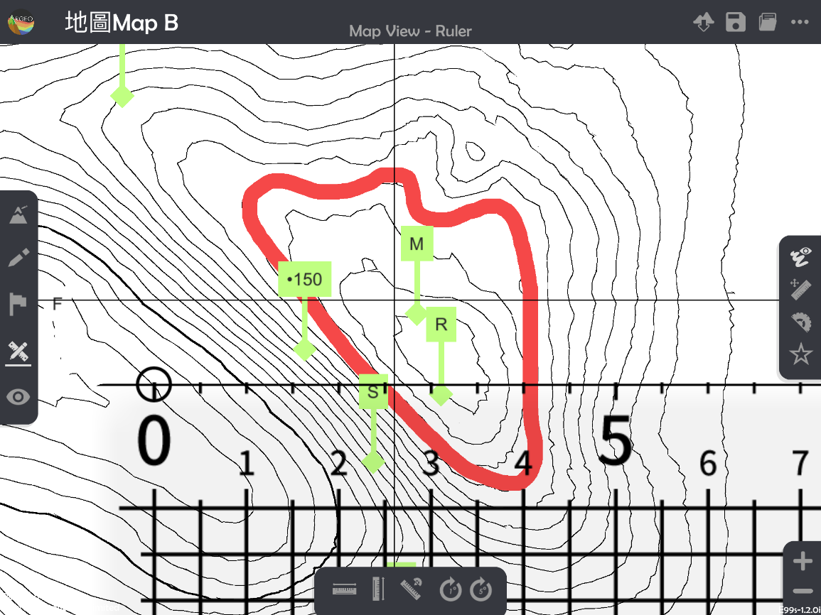
按「呼喚直尺」|get_ruler|。
Apply “Get Ruler
 ”.
”.
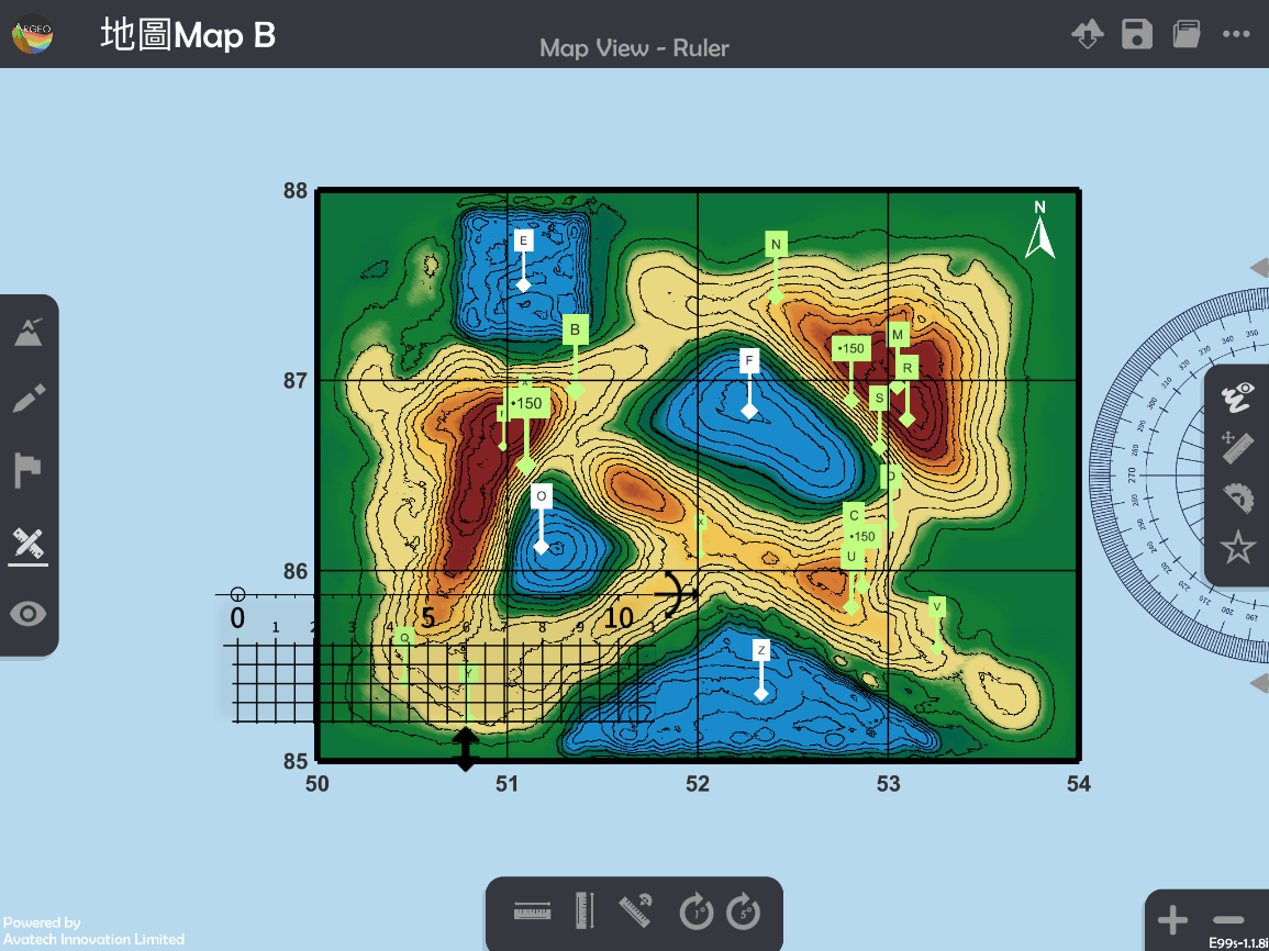
放置和調校直尺以量度圖案的長和闊。
*可按「水平直尺
 」和「垂直直尺
  」以調整直尺至水平或垂直。
*可按「放大」和「縮小」以調整地圖介面,減小誤差。
“Horizontal Ruler
” and “Vertical Ruler ” can be applied to adjust the ruler to horizontal or vertical.“Enlarge” and “Reduce” can be applied to adjust the “Map view” to reduce the measurement error.
計算實際面積。
Calculate the actual area.
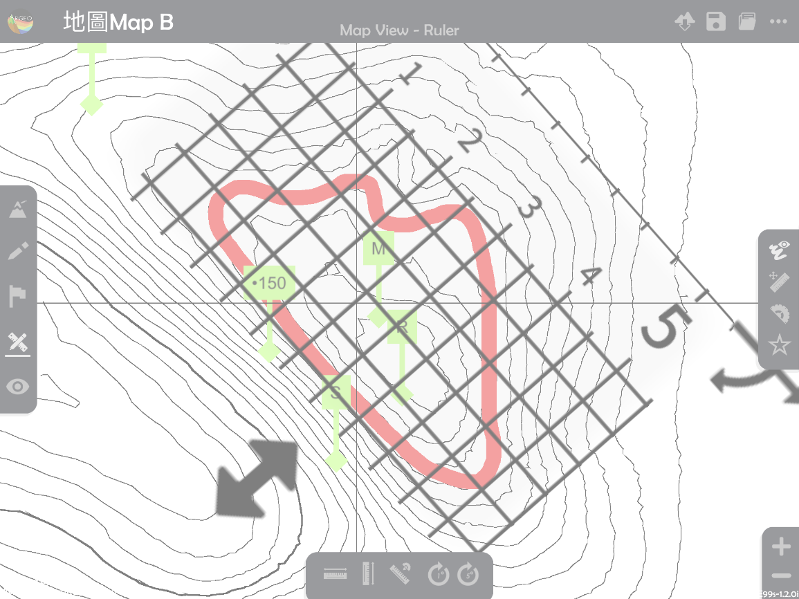
計算不規則形狀物件的實際面積 Calculate the actual area of irregular-shape object.
選擇一個「預設地形(Preset Terrain)
」或使用「地形塑造 」功能建設一個地形,以下以在「地圖Map B」計算格網方格5286、5287、5386及5387中深啡色山體的部份的實際面積為例子。Select a “Preset Terrain
” or use “Terrain Modifying ” function to form a terrain. The following example is to calculate the actual area of hill, which in dark brown colour in grid squares 5286, 5287, 5386, and 5387.
使用「地圖介面
」。Apply “Map View
「.
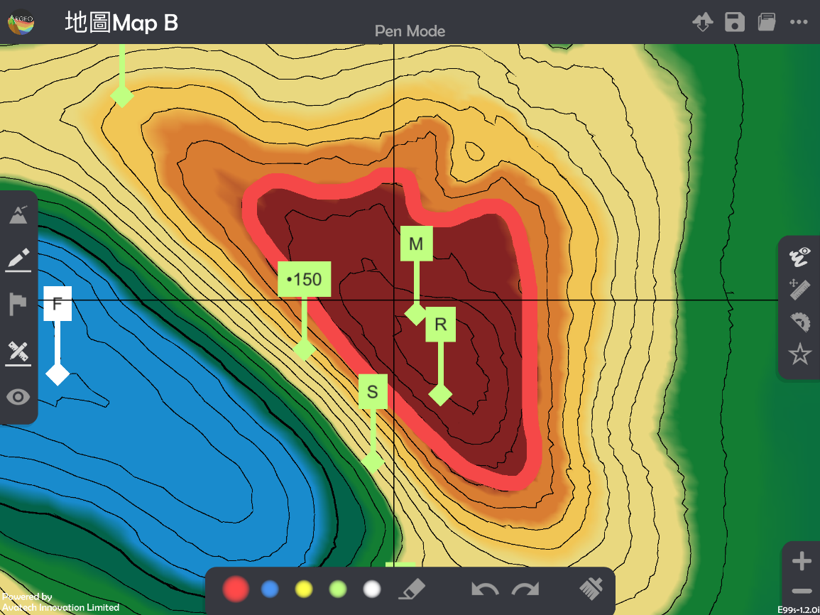
選擇「繪圖工具
 」,並勾畫出想量度的面積。
*不建議使用白色繪畫,因在隨後的步驟會難以計算面積。
*可按「放大」和「縮小」以調整地圖介面,減小誤差。
Select “Drawing Tools ” and sketch the outline of the area which needs to be measured.
*White colour is NOT suggested to use in sketching as it will be difficult to calculate the area in the following steps.
*“Enlarge” and “Reduce” can be applied to adjust the “Map view” to reduce the error.
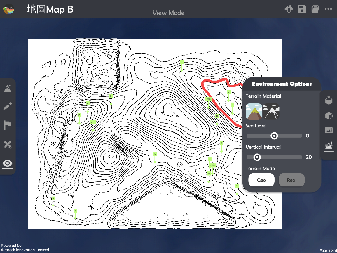
使用「觀察模式
 」。
」。Apply 「View Mode
「.
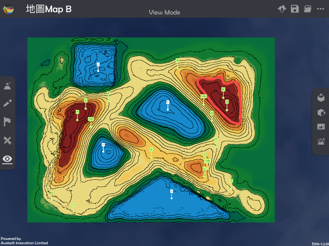
選擇「環境調整
 」,並在地貌顏色選擇黑白色
  。
。Apply “Environment Option
” and select the terrain material in black and white (missing signal logo).
使用「地圖介面
」。
Apply “Map View
按「呼喚直尺 |ruler|」。
Select “Call Ruler
”.
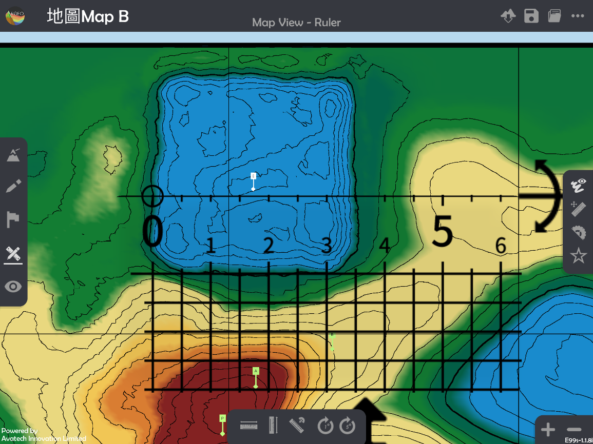
把直尺上的方格覆蓋在物件上。
*應把直尺調校至取得最多的完整方格。
Cover the grids on the object.
*Try to get as more complete squares as possible, when adjusting the ruler.
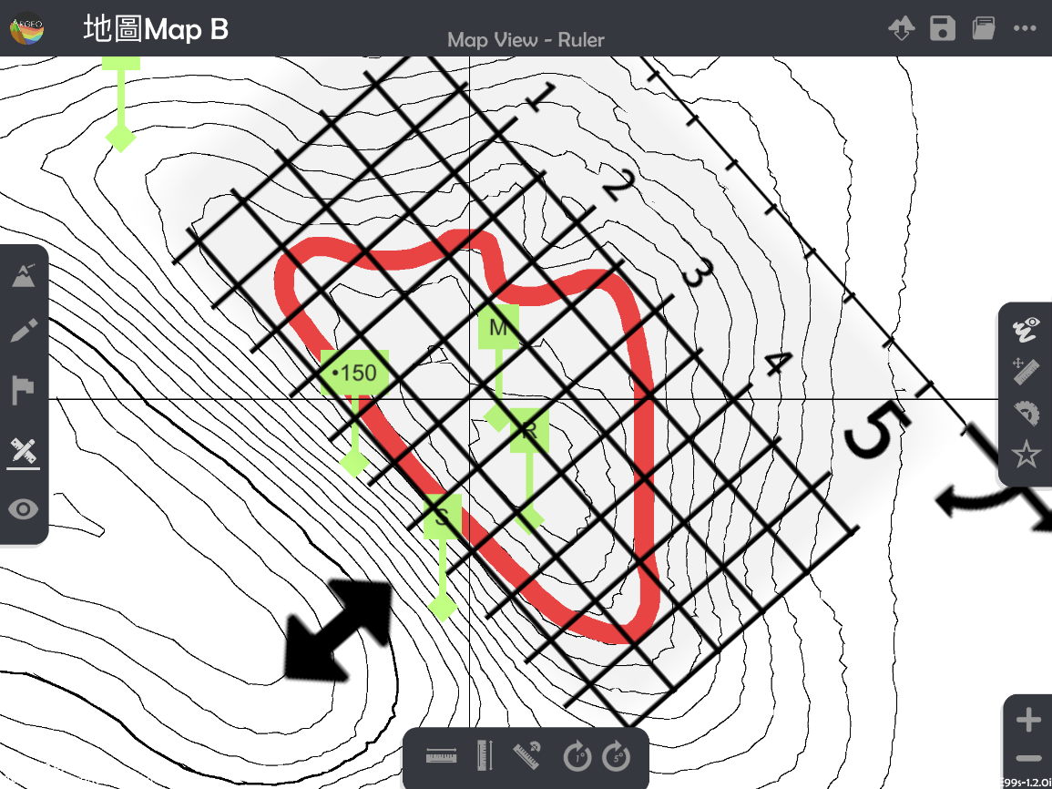
數點完整方格及不完整方格的數目。
*紅色數字為完整方格、藍色數字為不完整方格。
Count the number of complete and incomplete squares.
*The red numbers are the complete squares, while the blue numbers are the incomplete squares.
計算總格數。
Calculate the total number of squares.
計算實際面積。
Calculate the actual area.
下載教學資源
教學指引 按此下載
工作紙及答案(中文版) 按此下載
工作紙及答案(英文版) 按此下載