互見度 Intervisibility
教學指引
以下示範如何以 ARGEO Portable 教導互見度單元。
The following demonstration shows the teaching procedures of intervisibility by using ARGEO Portable.
選擇一個「預設地形(Preset Terrain)
 」或使用「地形塑造
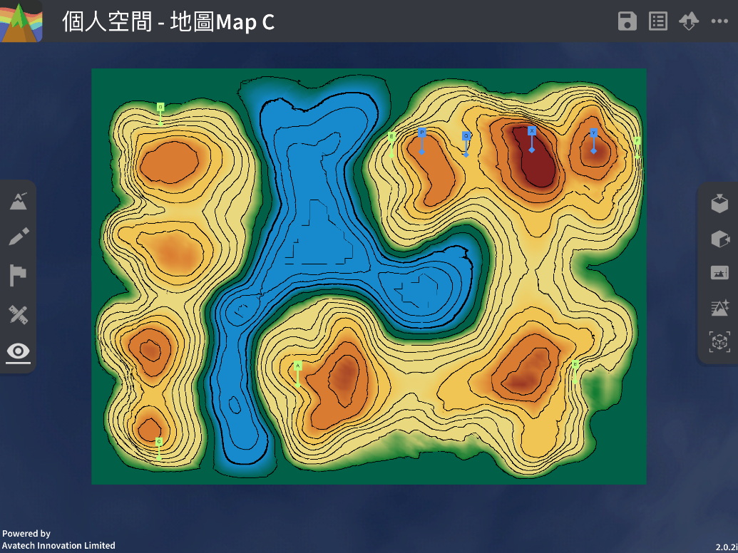
  」功能建設一個地形,以下以在「地圖Map C Preset Terrain」分辨E點到F點的互見度為例子。
Select a landform from “Preset Terrain”
or use “Terrain Modifying” function to create a landform. The following example is to determine the intervisibility of point E to F in “地圖Map C Preset Terrain”.
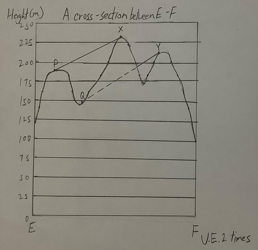
繪畫E點到F點的橫切面圖。(參閱橫切面指引)
Draw the cross-section between point E to F. (Refer to cross-section guideline)
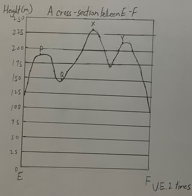
分辨橫切面圖中的兩點是否互見。
Determine the two points in the cross-section are visible or not.
下載教學資源
教學指引 按此下載
工作紙及答案(中文版) 按此下載
工作紙及答案(英文版) 按此下載