地形 Relief
教學指引
以下示範如何以 ARGEO Portable 教導地形單元。
The following demonstration shows the teaching procedures of Relief by using ARGEO Portable.
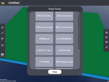
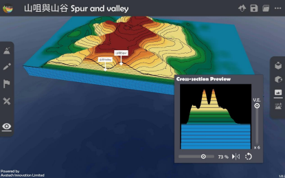
選擇一個「預設地形(Preset Terrain)|preset_terrain|」,並選擇想教授的地形,以下以 選擇「山咀與山谷 Spur and valley」為例子。
Select a relief which you want to teach in “Preset Terrain
 ”. The following example is “山咀與山谷 Spur and valley”.
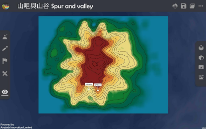
使用「俯視角度
 」功能觀察地形的等高線。
Use“Top View
”function to observe the contour line of the relief.
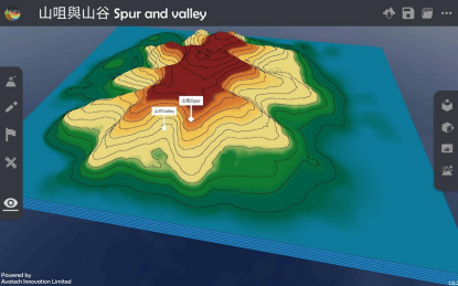
選擇「觀察模式
 」調校視角以觀察地形。
Use“View Mode
”to adjust the camera to observe the relief.
選擇「橫切面
 」功能,並以滑桿標調校橫切面至合適的位置。
Use “Cross-section
”function and adjust the slider to the suitable position.
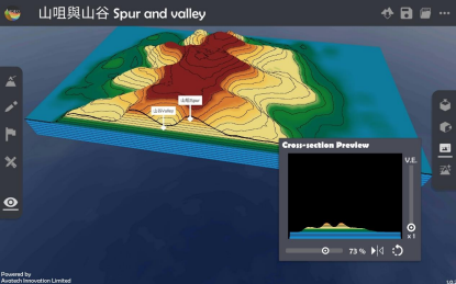
調校垂直誇大率觀察橫切面圖。
Adjuct the vertical exaggeration to observe the cross-section.
下載教學資源
教學指引 按此下載
工作紙及答案(中文版) 按此下載
工作紙及答案(英文版) 按此下載