橫切面 Cross-section
教學指引
以下示範如何以 ARGEO Portable 教導橫切面單元。
The following demonstration shows the teaching procedures of cross-section by using ARGEO Portable.
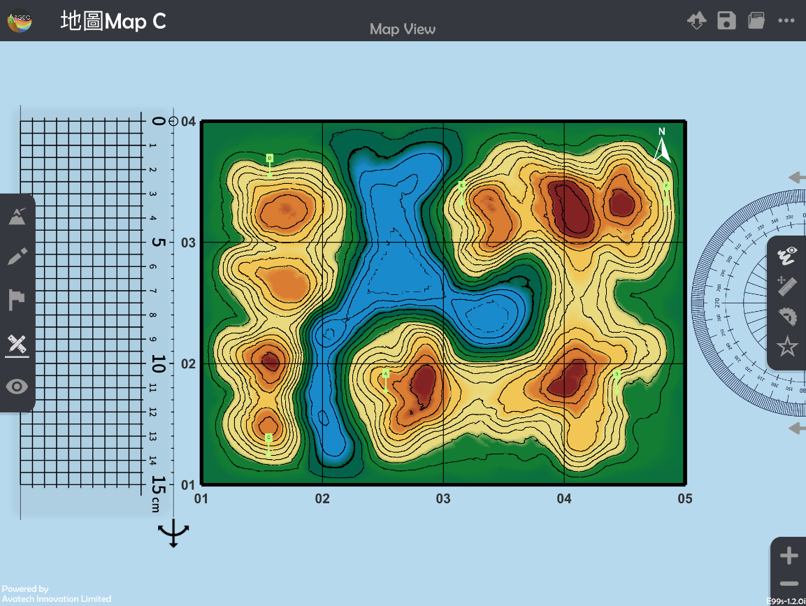
選擇一個「預設地形(Preset Terrain)
 」或使用「地形塑造
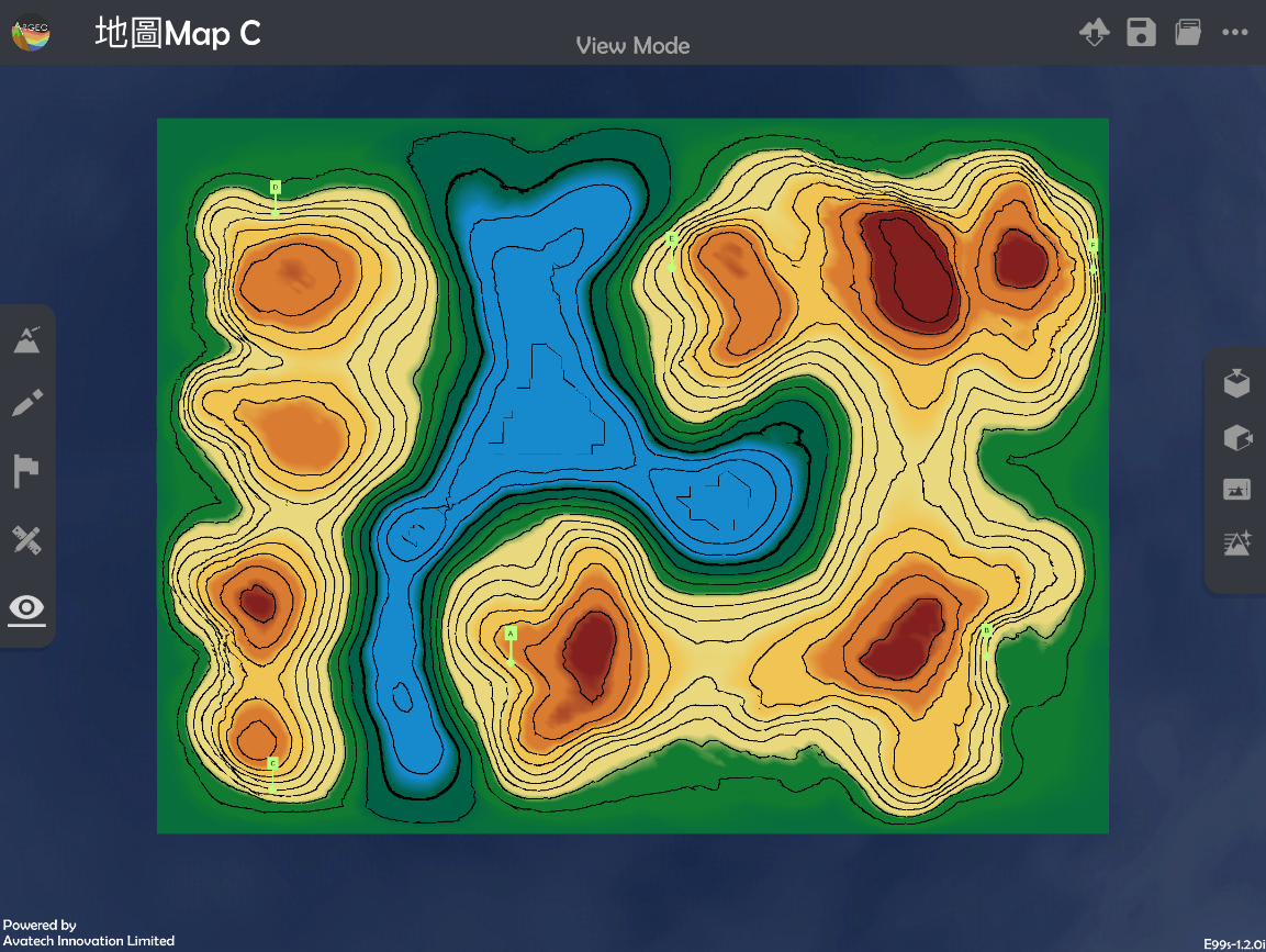
  」功能建設一個地形,以下以在「地圖Map C Preset Terrain」繪畫A點到B點的橫切面圖為例子。
Select a landform from “Preset Terrain
” or use “Terrain Modifying ”function to create a landform. The following example is to draw a cross-section from point A to B in “地圖Map C Preset Terrain”.

使用「地圖介面
 」。
」。Apply “Map View
”.
按「呼喚直尺
 」。
」。Apply “Get Ruler
”.
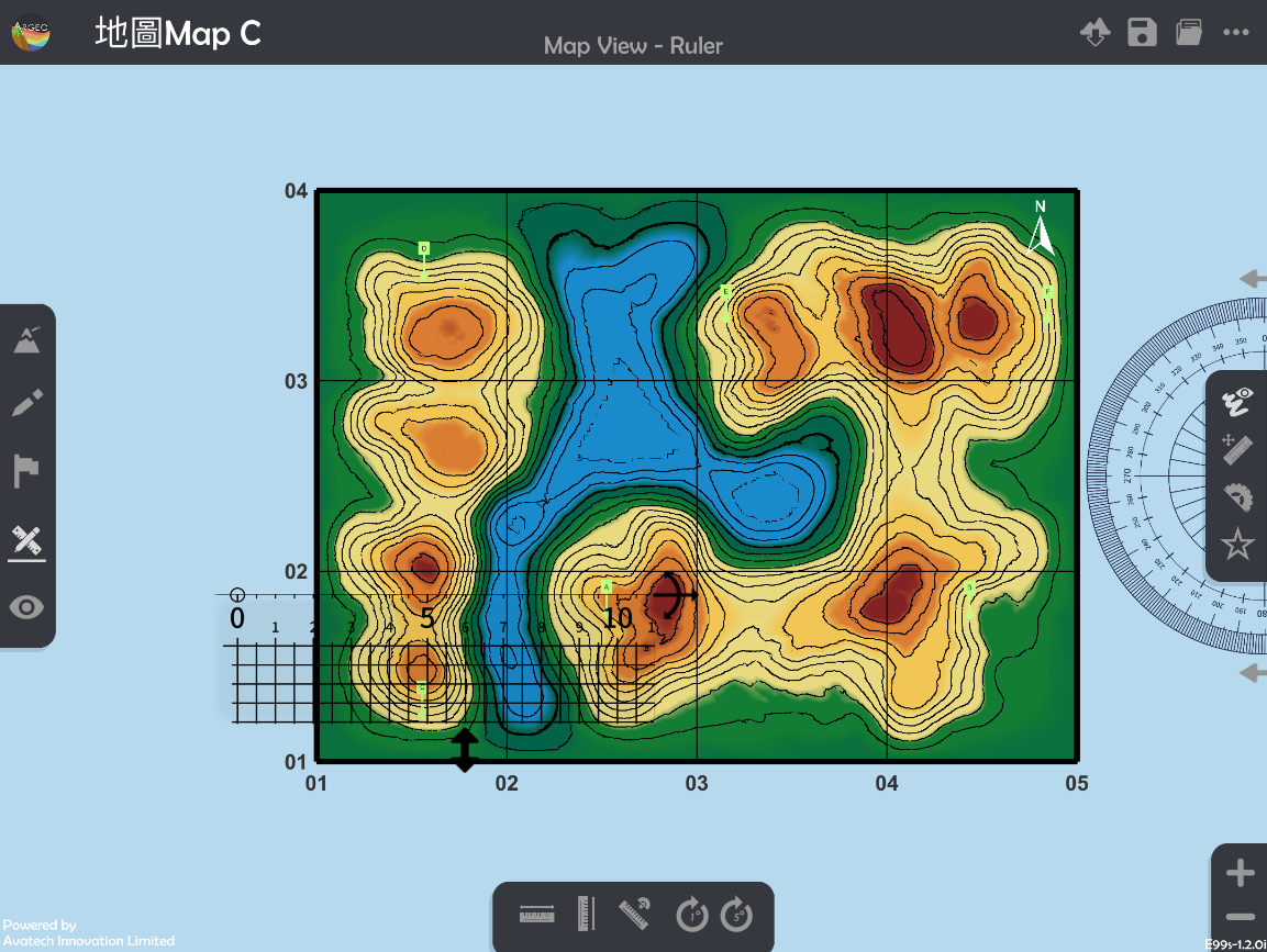
放置和調校直尺連接AB兩點。
Place and adjust the ruler on Point A and B.
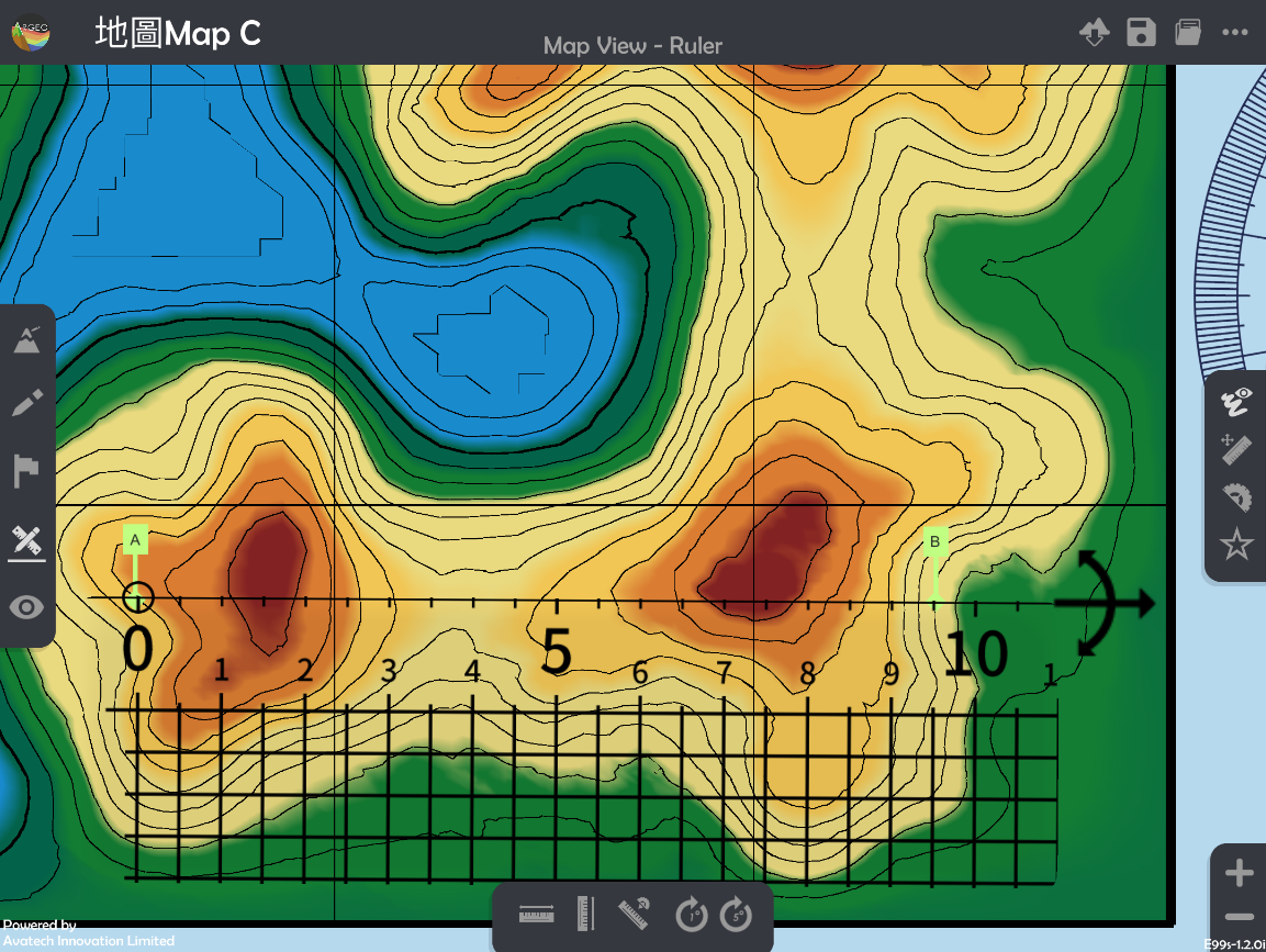
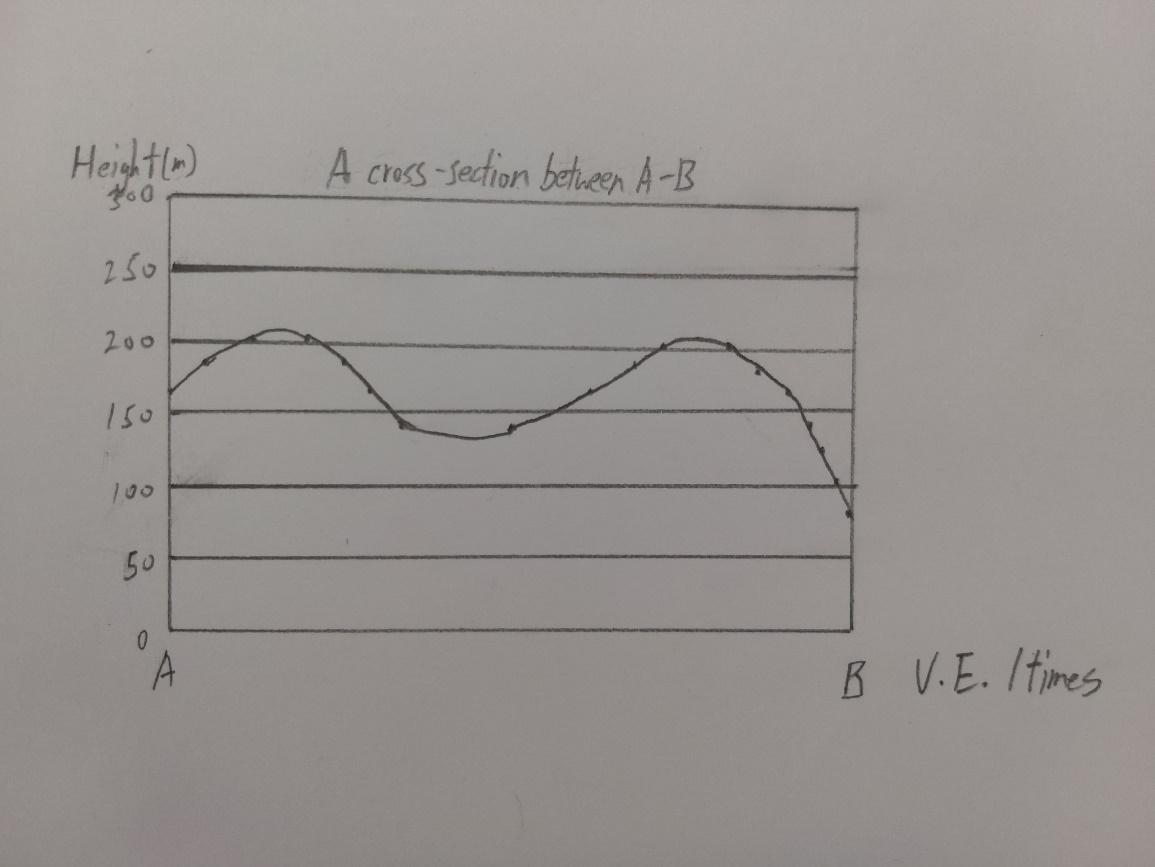
將AB兩點所穿過的等高線記錄在現實的紙條和直尺上。
Record the height of contour lines across the Point A and B on a piece of paper and ruler in real life.
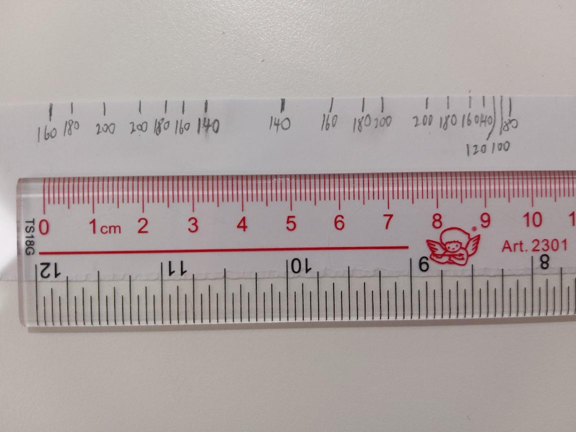
利用已記錄高度的紙條繪畫橫切面圖。
Draw the cross-section with the paper which records the height.
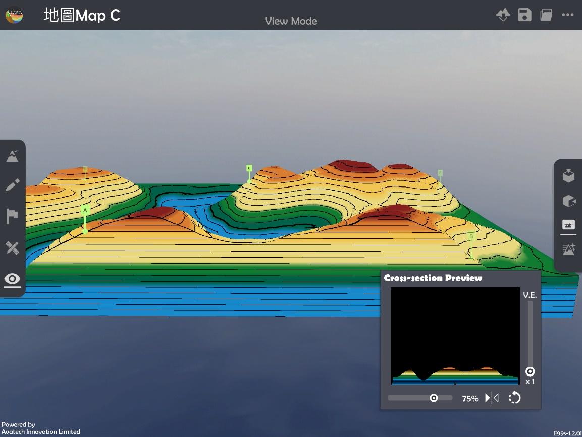
使用「觀察模式
 」。
」。Apply “View Mode
”.
按「橫切面
 」,並使用滑桿標調整橫切面位置和垂直誇大率,核對手繪橫切面圖。
Select “Cross-section
” and use the slider to adjuct and position of cross-section and vertical exaggeration to check the cross-section.
下載教學資源
教學指引 按此下載
工作紙及答案(中文版) 按此下載
工作紙及答案(英文版) 按此下載