Intervisibility
Teaching Demonstration
The following demonstration shows the teaching procedures of intervisibility by using ARGEO Portable.
Select a landform from “Preset Terrain”
 or use “Terrain Modifying”
 function to create a landform. The following example is to determine the intervisibility of point E to F in “地圖Map C Preset Terrain”.
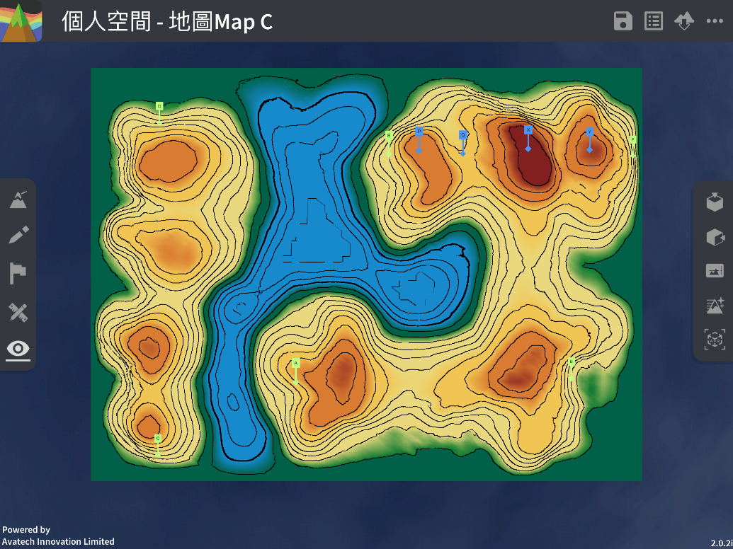
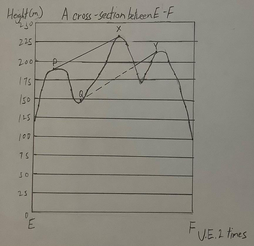
Draw the cross-section between point E to F. (Refer to cross-section guideline)

Determine the two points in the cross-section are visible or not.
下載教學資源
Teaching Demonstration Download Here
工作紙及答案(中文版) Download Here
工作紙及答案(英文版) Download Here